
Rocher Canon
Exploring the forest around Rocher Canon
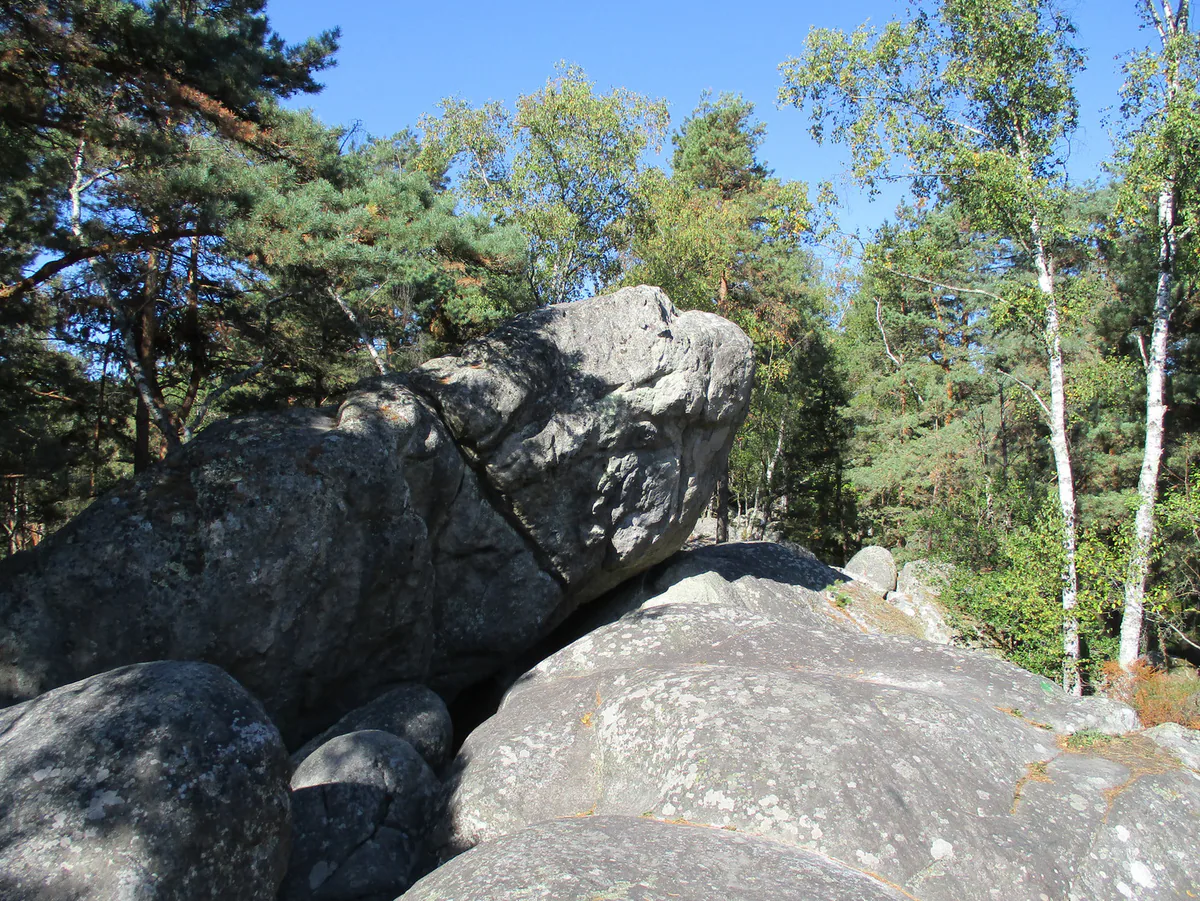
Rocher Canon captures much of what makes the massif special. Boulders, pines, sand, climbers and walkers share a superb but sensitive place.
PLACES AND LANDMARKS
Find it on the map
Rocher Canon car park
Bois-le-RoiFrance
The published start for the Rocher Canon and Mare aux Evées walk. Check access on the day.
A place shared by walkers and climbers
Rocher Canon draws walkers with the beauty of its boulders and climbers with its well-known problems. Even without climbing, it is a pleasure to follow paths between the rocks and watch climbers work out their lines. The area can be busy, so a little consideration goes a long way. Keep landing zones clear, do not step on climbing pads and picnic away from routes that are being climbed.
Access can change. Open the live ONF map before coming, especially following the July 2026 fires. A sign or closure on the ground takes priority over an older route.
A loop linking the boulders and the pond
Rocher Canon car park at 48.463937, 2.665395 gives access to the rocky area. To turn that visit into a complete walk, use the Mare aux Evées and Rocher Canon route published by Fontainebleau Tourisme.
The route starts at Rocher Canon car park and has a downloadable roadbook and GPX track. It places two strikingly different sides of the forest next to one another: Rocher Canon’s sandstone boulder fields and the damp, almost geometric landscape of Mare aux Evées. It is a far better way to understand the north of the massif than collecting improvised detours between the rocks.
The outing in figures
- Published distance: 5 km.
- Listed grade: easy.
- Start: Rocher Canon car park at Bois-le-Roi.
- Preparation: a roadbook and GPS track are available from the tourist-office route page.
- Route devised by: ONF and Les Amis de la Forêt de Fontainebleau.
Five kilometres over this ground does not feel like five kilometres on a pavement. Stops among the rocks, sand and junctions all take time. Allow a genuine half-day if you want to notice the landscape, pause and return without watching the clock.
Four landscapes rather than one attraction
At the start, Rocher Canon is all boulders, pines and sandy passages. Look for the oak nicknamed “Bonsaï”, whose twisted trunk appears to sit on the sandstone. It is not a checkpoint worth reaching off path; follow the roadbook and enjoy it if it lies on your route.
The broad avenues then change the scale. They began to be cut from the reign of Henri IV onwards to make royal hunts easier to follow. Star-shaped junctions allowed the court to travel behind the hunt by carriage. When several roads open in front of you, the pattern therefore reflects a particular use of the forest rather than a simple taste for symmetry.
As you approach Mare aux Evées, the ground grows damper and ditches structure the view. Finally, the central basin and planted trees around the pond create a stop quite unlike the boulder field. This sequence is the real strength of the loop.
Why Mare aux Evées is worth the walk
The network of ditches around the pond is not a natural stream system. During the reign of Louis-Philippe, more than twenty kilometres of ditches were dug in a star pattern to drain the wet ground into a central basin of about 12,000 m³. Cypress trees planted around the water make the change of atmosphere even more pronounced. Within a few kilometres, you move from sand and sandstone to a historic feat of water management.
Take time to read the pattern of the ditches from the path. Do not cut between them to approach the water, as the banks and wet ground are vulnerable to trampling. The roadbook also points out trees and forest perspectives, including the oak nicknamed “Bonsaï” and broad avenues inherited from the hunting forest. They are useful landmarks that give shape to the walk without turning every stop into a compulsory photograph.
The bald cypresses deserve a proper pause
Bald cypresses from Louisiana were planted around Mare aux Evées and nearby Mare à Bauge in about 1830. Look around the base of the trees: some roots produce upright growths known as pneumatophores. They give the water’s edge an unusual outline in a forest better known for oak, beech and pine.
The avenue names and several notable trees also recall an old arboretum. There is no need to turn the walk into a botany test. Simply compare the bark, shape and roots of the cypresses with the pines seen at Rocher Canon. The contrast becomes easy to recognise without specialist knowledge.
Binoculars are useful beside the pond because they let you observe without leaving the path. Keep picnic remains in your bag. Feeding birds changes their behaviour and draws wildlife towards busy paths.
For a straightforward walk
Choose a short, waymarked loop that stays on authorised paths. Small trails between boulders often serve individual climbing problems rather than continuing along the walking route. An offline map and a few clearly identified points will keep you from walking in circles.
If you follow the loop towards Mare aux Evées, keep the overall route visible instead of trusting the most obvious trails around the boulders. Many simply reach a climbing problem or rejoin another track by an unclear line. At the first major junction, take thirty seconds to orient the map and identify the next forest road. That short pause works better than making several corrections later.
For a walk confined to Rocher Canon, set a time limit rather than a list of boulders you must see. An hour among the rocks can already be rewarding. Return by the same main path if your group begins to lose its bearings; there is no need to invent a loop.
With children, agree on rules before entering the boulder fields. Keep them within earshot, do not let them run through landing areas and never climb higher than you can comfortably descend. Sand is tiring underfoot and can make the return feel longer.
To make the 5 km engaging, give the group four things to notice: a boulder with a curious shape, a star junction, the first drainage ditch and a bald cypress. It gives the walk a rhythm without leaving the route or inventing an artificial treasure hunt.
If you have come to boulder
Wait until the rock is completely dry. Use an appropriate brush, remove your marks after the session and place pads without crushing vegetation unnecessarily. On a first outing, a guide can teach you how to spot and land safely. Our Bouldering in Fontainebleau guide covers these basics.
Coloured circuits offer useful markers, but they do not replace judgement or a recent guidebook. A colour does not mean that every problem suits the same ability or reach.
Walkers can make sharing the area easier too. When a climber is preparing, go around the place where they might fall and do not sit on a pad lying on the ground. When a family passes, climbers can leave a clear way through. Rocher Canon works well when everyone understands that the same rock can be a climbing problem, a landscape feature and the edge of a footpath.
After rain, resist the temptation to “test” the sandstone with a hand or shoe. The surface can appear dry while the rock remains damp within. Stay on the paths and leave climbing for another day. The woodland and Mare aux Evées make this a worthwhile outing without touching a single boulder.
Who will enjoy this outing?
- First-time visitors: the link to Mare aux Evées provides a clear thread and two landscapes that are easy to recognise.
- Families: keep the distance modest, watch the landing areas and make the pond the objective rather than attempting a large circuit.
- A climber with a non-climber: plan a shared walk first, followed by a short session in one spot instead of moving everybody from boulder to boulder.
- People interested in the forest: choose a quiet morning and notice how the trees, ground and light change between the rocks and wetland.
Do not rely on finding drinking water or a shop during the loop. Bring what you need and take every wrapper home. Sand quickly finds its way into low shoes, so comfortable closed footwear is more useful than highly technical equipment.
The visitor route lists all four French Tourisme et Handicap categories. That is a useful first indication, but consult the roadbook and current access information when somebody in the group needs precise details about surfaces, gradients or temporary obstacles. A car park and an accreditation cannot describe every metre of a woodland path following bad weather.
When should you go?
Morning tends to be quieter around the boulders. The pond feels more open around midday, although sunny weekends bring more people to the start. After wet weather, choose this outing for walking and observation rather than climbing. In summer, the wooded avenues provide shade while the area around the pond can feel brighter and warmer.
If the car park is full, do not create a space on the verge. A 5 km walk quickly loses its appeal when the starting point damages the forest edge. Return earlier on another day or choose Samois, where the relationship with the Seine makes for a completely different outing.
Half a day is enough
Rocher Canon is best enjoyed without a packed schedule. Walk, watch climbers on a few lines, pause away from landing zones and head back while everyone still has energy. For a different atmosphere later in the day, see our walk around Samois-sur-Seine.
Before leaving the car park, check the ONF access map one final time. If the loop to Mare aux Evées meets a closure, choose a short authorised walk in the area or move to a different start altogether. The GPS point locates the car park; today’s map decides the route.