
Trois Pignons
Walks in the Trois Pignons forest
More open and sometimes more confusing than the heart of the massif, Trois Pignons rewards walkers who prepare a map and take their time.
PLACES AND LANDMARKS
Find it on the map
Rocher Cailleau area, Trois Pignons
Noisy-sur-ÉcoleFrance
For orientation only. Check the ONF map before choosing a trailhead.
A forest that changes with every fold in the ground
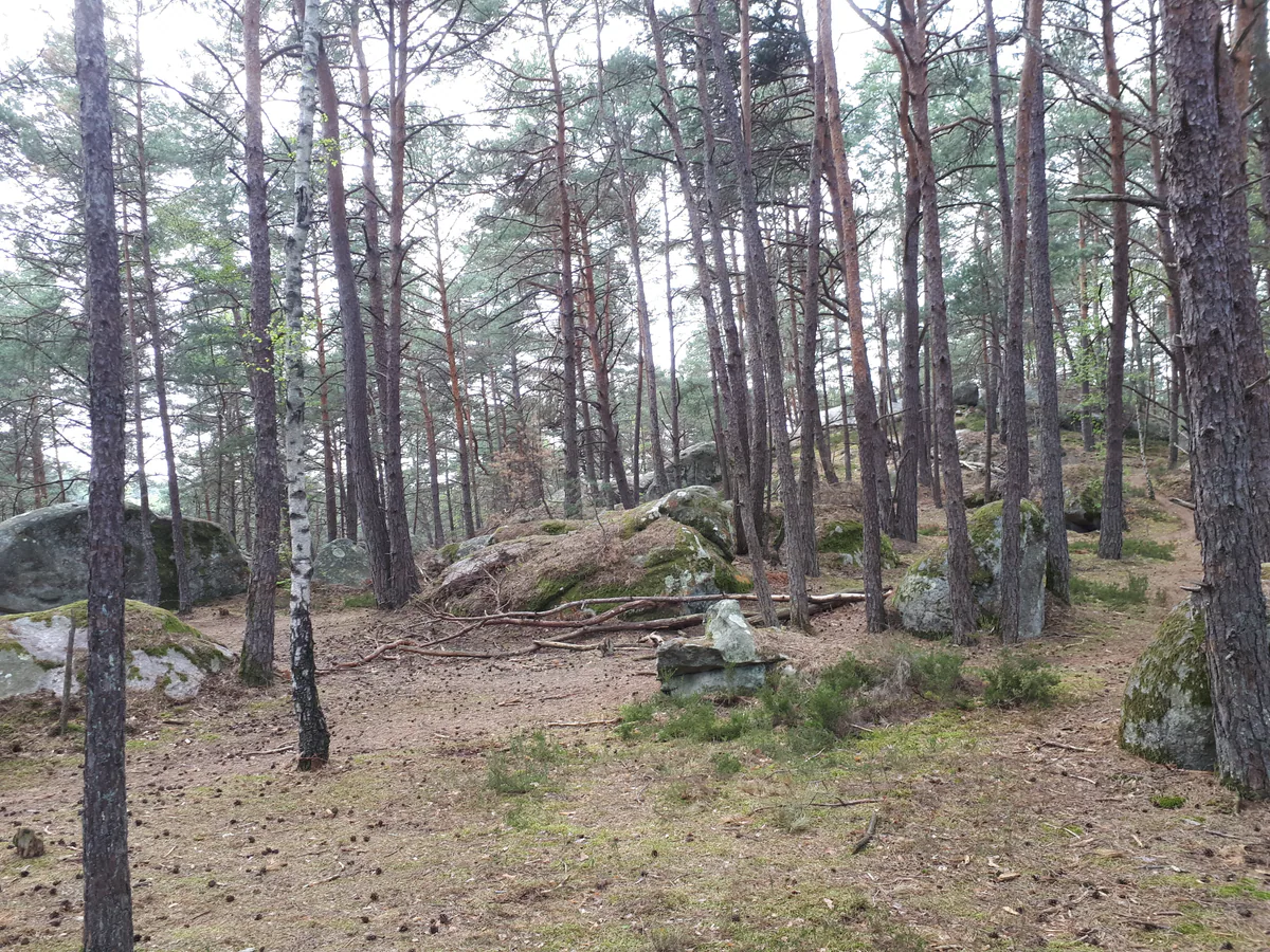
Trois Pignons combines open sand, birches, pines, heath and long bands of sandstone. A path may cross a bright clearing, disappear between boulders and enter a pine wood within minutes. This variety is the area’s great pleasure, but it also makes navigation less obvious than it seems. Two junctions can look remarkably alike, and a climbers’ path is not necessarily a walking route.
Rocher Cailleau, on the western side of Trois Pignons, helps locate the area around 48.359372, 2.534251. Do not treat it as an automatically accessible trailhead. The July 2026 fires seriously affected the massif and access conditions have changed.
Essential information after the 2026 fires
Your first task is not choosing a distance. It is opening the ONF interactive map of accessible areas. The map distinguishes reopened ground from areas that remain temporarily closed. ONF warns that trees with fire-damaged roots may fall long after the flames are out and that some soils remain unstable. Never cross a fence, barrier or closure sign on the ground, even when your walking app shows a path beyond it.
There is another crucial point. Les Amis de la Forêt de Fontainebleau currently report that the 25 Bosses circuit is no longer passable following the July fires. This demanding 15 km route should not be used as a plan at present. The same page lists affected blue and yellow trails. Check it alongside the ONF map shortly before leaving, since a saved track cannot show a new diversion or safety operation.
Finding your bearings around Rocher Cailleau
Rocher Cailleau is a familiar gateway on the western side of Trois Pignons. The official page about the sands of the Trois Pignons massif recommends it when the Roche aux Sabots and Cul du Chien area is overflowing with cars. That advice applies only when the ONF map and signs on the day confirm access to the car park and nearby paths.
While the 25 Bosses circuit is listed as impassable, do not enter Trois Pignons expecting to improvise a loop. Set out only when the ONF map shows the area open and you have a current official route sheet for a continuous itinerary. Otherwise, choose one of the documented alternatives below. If the area is shown as closed, do not hunt for a side entrance.
Reading the area from Noisy-sur-École
The main names do not describe the same place. Roche aux Sabots is a familiar access point north-east of the Sables du Cul du Chien. Rocher Cailleau lies farther south and provides another way into the massif. Croix Saint-Jérôme, elsewhere again, was used as the start of the major sporting circuit. Entering any one of these names into a navigation app without first choosing a route can leave you several kilometres from the place you expected.
Fontainebleau Tourisme describes an approach to the Sables du Cul du Chien of about 20 minutes from the Noisy-sur-École side, using the Chemin de la Plaine de Jean des Vignes. At the end of that approach, the woodland opens onto a broad sandy expanse ringed by pines and boulders. Le Bilboquet, a solitary rock with a distinctive outline, is its best-known landmark. This helps explain the layout, but follow the approach only when the current ONF map confirms access across the whole area.
Other familiar names, La Tortue, La Souris, L’Éléphant perché, Le Diplodocus and Le Toit du Cul du Chien, are spread around bouldering circuits and the wider massif. They do not form one signposted walk to be visited in that order. Pick two or three landmarks close to your chosen track instead of turning the outing into a hunt along a maze of minor paths.
Why the 25 Bosses is not an option at present
The red circuit is not a family stroll around the sand. The Fontainebleau Tourisme introduction to Trois Pignons describes a mountaineering training route with about 800 m of ascent and five to seven hours of walking, usually approached from Croix Saint-Jérôme. Narrow rocky sections call for free hands and confidence on sustained uneven ground.
Those facts explain the character of the route, but they are not an invitation to attempt it now. AAFF declares the circuit impassable following the fires. Do not set out to link a few random “bosses” from an open car park. A closure on one section breaks the continuity of the loop, while emergency access must remain unobstructed.
Making a genuine fallback plan
When Rocher Cailleau or the sands are inaccessible, simply changing car parks within Trois Pignons does not solve the problem. The tourist office names the so-called Saharan dunes from Grands Feuillards and Mont Blanc in Commanderie Forest as alternative sandy landscapes. They lie in different areas and must also be checked on the ONF map.
For a documented loop, the Grands Feuillards guide describes a 7 km circuit from its official car park. In Commanderie Forest, the Cinq Croix circuit covers about 10 km from Saint-Mathurin basilica, while the Fontaine Saint-Mathurin walk offers a 2 to 3 km option from the church’s north door. Check that your chosen route is open before travelling. If none is clearly accessible, spend the day in Noisy-sur-École or Milly-la-Forêt.
Before setting out
- Check the ONF map on the day.
- Read the latest trail status from Les Amis de la Forêt.
- Save the route and map for offline use.
- Note the exact name of the authorised car park, not merely “Trois Pignons”.
- Set a turnaround time and keep enough water for delays.
Sandstone, sand and local memory
The sand is not an imported feature. Fontainebleau Tourisme explains that a warm sea covered this region about 30 million years ago, leaving quartz deposits that eventually formed both the pale sands and the sandstone. Around Cul du Chien, distinctively shaped boulders such as Le Bilboquet became landmarks for walkers and climbers. Treat them as part of a vulnerable landscape rather than outdoor furniture.
The area also carries a sombre wartime history. The official introduction to Noisy-sur-École describes how an extensive fire was deliberately started during the Occupation in 1943 in an attempt to disrupt the Publican Resistance network operating in Vallée Close. A monument bearing the Cross of Lorraine preserves that memory. Pause respectfully if a current open route approaches it, and do not leave the permitted paths.
Which outing suits your group?
For a first visit, choose a short loop only when a current route sheet and the ONF map confirm the same open itinerary. Sand tires the calves, and weaving around boulders quickly slows a group. With children, prefer one of the documented short alternatives while access to Trois Pignons remains uncertain. Open areas can become very hot and sometimes offer little shade.
Experienced hikers will enjoy the relief, but experience does not grant access through a closure. After a wildfire, knowing when to turn back is part of good routecraft. Stay out of woodland in strong winds. After rain, avoid climbing on wet sandstone and keep off eroded slopes.
Sharing the area with climbers
Trois Pignons is renowned for bouldering. You will see pads beneath the rocks, painted circuit numbers and small paths connecting problems. Avoid stepping on equipment, keep picnics away from landing zones and give climbers space. Coloured arrows on a bouldering circuit do not mark your hike.
If climbing is your purpose, read Bouldering in Fontainebleau. If you are walking, follow only the pedestrian route you selected. Wet sandstone is easily damaged by climbing shoes and becomes slippery. Give it time to dry rather than turning a walk into an improvised session.
Building a day around Noisy-sur-École
Noisy-sur-École is the natural companion to this area. Its Notre-Dame-de-l’Assomption church, streets and history bring the day back to a human scale after the open forest. There is no railway station at the trailheads. Milly-la-Forêt is another possibility, but avoid adding several separate massifs after an already demanding walk.
Public transport is less direct here than around Fontainebleau-Avon. Check the outward journey and last return on Île-de-France Mobilités, then measure the distance from the stop to the actual trailhead. Our Fontainebleau without a car guide helps you plan the whole chain. For an overnight stay, see Where to stay and pick a base for the access point that is open, rather than accommodation chosen only because it carries the Trois Pignons name.