
Gorges de Franchard
Walks around Franchard and its gorges
Franchard packs a great deal into a short distance. A small loop is enough to feel the terrain, study the sandstone and understand why the area deserves care.
PLACES AND LANDMARKS
Find it on the map
Parking des Gorges de Franchard, D301
FontainebleauFrance
The start shown on the official trail page. Check access on the ONF map on the day.
Why Franchard stays with you
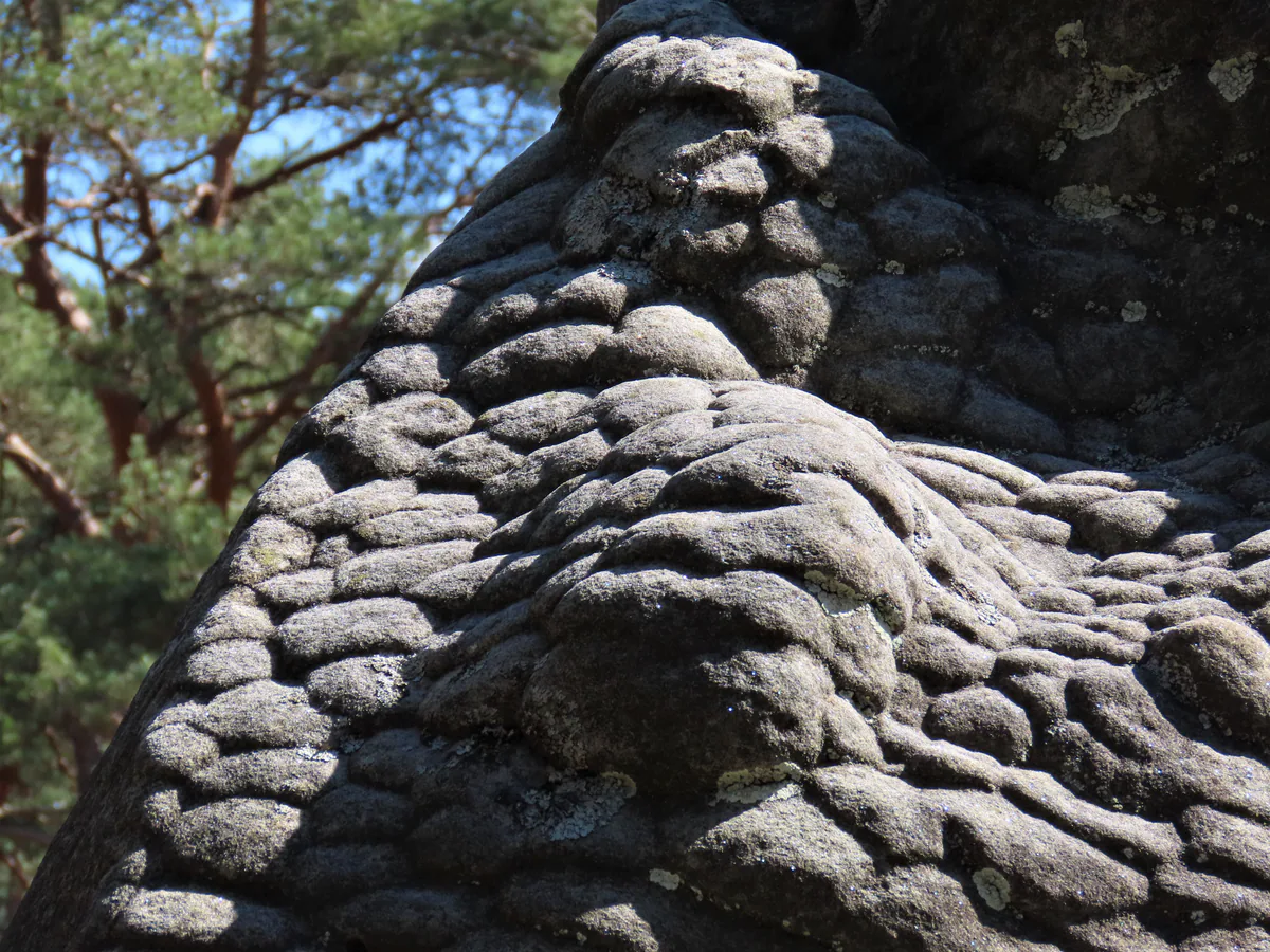
Pale sand, piled boulders and narrow passages give the Gorges de Franchard an almost theatrical landscape. Within a few hundred metres, high oak woodland gives way to open heath and then a sandstone corridor. There is no need to turn this into an endurance test. A short loop with plenty of pauses reveals how roots find their way between the rocks and how the light shifts beneath pines and oaks.
Franchard works best as one well-chosen loop rather than a long chain of detours. The short gorge trail, yellow trail 16 and the arboretum suit different kinds of day. Pick one before setting out and save the others for another visit.
The short Gorges de Franchard loop
The official Gorges de Franchard trail page and its roadbook describe a 2.5 km loop beginning at the Parking des Gorges de Franchard on the D301. Allow about 1 hour 30 minutes, and longer if you take the short viewpoint detour or enjoy frequent stops. Follow the waymarks showing two yellow figures. The listing grades the route as moderate, although its short length makes it suitable for many families who are comfortable walking on uneven ground.
From the car park, Route de l’Ermitage runs between the Maison de la Biosphère et de la Forêt and the hermitage. The marked trail begins beside the first rocks. It then reaches Route de la Roche-qui-Pleure, winds through the gorge landscape and returns along Route de l’Ermitage. The official roadbook says the viewpoint option adds a 500 m return walk and roughly 15 to 20 minutes.
Official loop at a glance
- Distance: 2.5 km.
- Time to allow: about 1 hour 30 minutes, excluding long stops.
- Start: Parking des Gorges de Franchard, D301, Fontainebleau.
- Waymarking: two yellow figures.
- Ground: sand, roots, steps and rocky passages.
- Map and track: the Fontainebleau Tourisme page provides a roadbook and GPX file.
Read the loop before walking it
The roadbook currently offered by the tourist office breaks the route into eight straightforward stages. From the car park, pass the timber ecotourism centre with the stone hermitage on the other side. Route de l’Ermitage leads for about 280 m to the first rocks and the sign bearing the two yellow figures. This is where the loop properly begins, not at the first minor path visible from the parking area.
The route then turns onto Route de la Roche-qui-Pleure for roughly 100 metres before taking the first path on the right. After about 140 m, another right turn joins the Gorges de Franchard trail for the main rocky section, which runs for around 900 m. When it reaches Route du Carnage, there is a clear choice: continue down the wooden steps or add the return walk to the viewpoint.
At the bottom of the steps, Route de l’Ermitage leads back towards the start for about one kilometre. The watchtower and ecotourism centre become the final landmarks before the car park. Remembering this sequence, hermitage, Roche-qui-Pleure, gorge, Route du Carnage and Route de l’Ermitage, is far more useful than trying to memorise every side path. On the ground, continue to follow the waymarks and any recent diversion.
Choosing between three Franchard routes
The 2.5 km loop is the natural first choice when the gorges are your main interest. AAFF also publishes yellow trail 16, a separate 6.3 km route from the same car park, listed at 1 hour 40 minutes with 48 m of ascent. Do not combine its distance with the short roadbook or switch between the two without the correct map.
Blue trail 7 would normally make a 5 km circuit through the Gorges de Franchard and Gorges du Houx. It is not a complete alternative in 2026: AAFF says the Gorges du Houx section is no longer passable. The links towards trail 6 and La Faisanderie must not be used to bypass the closure. Before choosing the short circuit or yellow trail 16, inspect the entire route on the day’s ONF map.
Three stops that bring the landscape to life
The Ermitage de Franchard recalls the religious recluses drawn to this secluded valley in the Middle Ages. A first hermitage was built in the 12th century. The site was destroyed and rebuilt before being abandoned early in the 18th century. The forest house visible today was later built over those remains during the reign of Louis-Philippe. A few quiet minutes here give the walk context before the rocks take centre stage.
Farther on, the Œil des Nations, or Eye of Nations, lies flat on the ground. It was unveiled in 1998 to mark 50 years since the International Union for Conservation of Nature was founded in Fontainebleau in 1948. Despite its name, this is not a lookout. It is a circular monument containing a heart of Fontainebleau oak. The Roche qui Pleure, or Weeping Rock, takes its name from the drops of water that appear in wet weather. Enjoy it from the path and resist the temptation to climb on damp sandstone.
The Arboretum and Hautes Plaines lie near the gorges, while Isatis and Cuisinière belong to other walking and climbing areas. Their proximity on a map does not make them one continuous loop. Stay with the route you selected and remember that AAFF currently lists the Gorges du Houx section of trail 7 as impassable.
Check access before lacing your boots
On the day of your walk, consult the ONF interactive map of accessible areas. Much of the massif reopened after the fires, but some areas remain closed because of weakened trees, unstable ground and safety work. A barrier, wooden fence or red closure sign on the ground always takes priority over a downloaded track.
Postpone the walk in strong winds. After rain, sandstone is slippery and more vulnerable to damage. Stay on the path, go around any obstacle that would require forcing a way through and do not create shortcuts across vegetation. If bouldering is your real aim, read our Fontainebleau climbing guide first.
With children or first-time walkers
The short loop works well when everyone has stable footwear and is happy to move slowly. Turn the outing into a search for small details: an unusual rock shape, pine bark, an oak leaf, the sound of wind in the branches. The boulders are not a safety-tested playground. Even a short fall can injure someone without pads and a spotter.
The accessible Arbor&Sens route in the nearby arboretum is another possibility when the gorge loop feels too rocky. Fontainebleau Tourisme describes a 1.5 km path with a guiding line and sandstone markers underfoot. Check that route on the same ONF access map before choosing it.
Arriving, parking and having a fallback
Use the official car park only. Verges and forest barriers must remain clear for emergency and forestry vehicles. Fine weekends bring the biggest wave of arrivals in late morning. An earlier start, a weekday or a visit outside peak hours is calmer. If the car park is full, change your plans rather than leaving the car somewhere fragile or prohibited.
There is no regular direct public-transport link from Fontainebleau-Avon station to the Franchard forest trailheads, as the Fontainebleau Tourisme practical FAQ explains. Without a car, arrange the final leg and especially the return in advance. A walk nearer a station will often be a better choice than a long approach along roads.
Our overview of the massif makes it easier to prepare a fallback. You can also spend the afternoon in Fontainebleau and return to Franchard on another day. One well-chosen short loop, with time to read the landscape, says far more than three areas rushed through before dark.