
Mont Aigu
A forest walk at Mont Aigu
Mont Aigu has noticeable relief without being a mountain. Its slopes, sand and roots can still make the walk take longer than the map suggests.
PLACES AND LANDMARKS
Find it on the map
Faisanderie car park, Carrefour du Coq
FontainebleauFrance
The published start of the orange mountain-bike circuit. Pedestrian blue trail number 8 remains listed as impassable.
A modest height that still feels like a climb
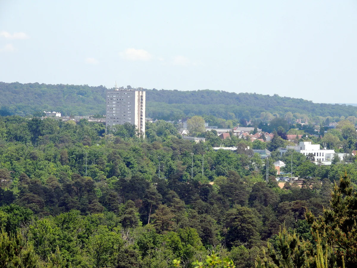
Mont Aigu is not a mountain, but the name suits the way the ground feels. Sand shifts beneath your feet, roots cross the slopes and boulders force small detours. Gaps in the trees reveal the folds of the wider forest and the edge of Fontainebleau. It is a rewarding place for understanding the landscape, but the published mountain-bike circuit and the currently closed pedestrian trail must be kept separate.
Read this before choosing Mont Aigu
Following the July 2026 fires, Les Amis de la Forêt de Fontainebleau states that blue trail no. 8, Rocher du Long Boyau and Mont Aigu, is no longer passable. That warning applies to one of the principal walking routes through this sector. Do not bypass a closure on an unmarked path or rely on a track downloaded before the fire.
Start with the ONF map of accessible areas, which is updated regularly, then check the AFF page again on the morning of your visit. If Mont Aigu or a connecting path remains closed, choose an officially open walk elsewhere in the forest. No viewpoint or boulder is worth crossing a closure fence. Fire-damaged roots can leave a tree unstable even when its trunk looks unharmed.
La Faisanderie provides the usable start
The Faisanderie car park at Carrefour du Coq is the starting point on the mountain-bike route sheet. It lies at the edge of the area rather than on the summit of Mont Aigu. Save the car park name and first junction instead of a general coordinate on the ridge.
Walkers should not take this mountain-bike start as evidence that a pedestrian loop is open. The AFF still lists blue trail 8 as impassable. Base any outing on the current ONF and AFF information and on a route sheet written for the activity you plan to do.
Two routes that should not be confused
Blue trail no. 8 is a Denecourt-Colinet walking route serving Rocher du Long Boyau and Mont Aigu. This is the trail that the AFF currently describes as impassable. Separately, Fontainebleau Tourisme publishes a Mont Aigu mountain-bike circuit devised by the ONF and the AFF. Its route sheet describes a 6 km loop taking about 1 hour 30 minutes, with orange mountain-bike waymarks, sandy sections and a start at the Faisanderie car park by Carrefour du Coq.
Those figures describe the published circuit, not a guarantee that it is fully open today. The start and some sections lie in a landscape affected by the 2026 restrictions. Use the mountain-bike route only if the ONF map and signs on the ground confirm that your entire loop is accessible. Cyclists should stay on the sections marked for bikes. The official sheet asks riders to remain out of forest compartments and to watch for walkers sharing the route.
The seven landmarks on the published bike circuit
The detailed Mont Aigu roadbook divides the loop into seven directions. Save it with the GPX track, then compare every section with the ONF map on the day of your ride. The sheet dates from June 2021. It explains the circuit well, but cannot reflect the 2026 closures.
- Carrefour du Coq to Mont Fessas. From the Faisanderie car park, take the road between Route du Coq and Route du Levraut. It runs straight to Carrefour du Mont Fessas. This relatively clear opening gives you time to find the orange marks and check that your bike, bag and brakes are properly adjusted.
- Route de l’Ermitage. Mont Fessas is a star-shaped junction. The roadbook calls for the sixth exit on the right, Route de l’Ermitage, as far as the meeting of Route Jean and Route Paul Delorme. Count the branches only after confirming the junction name.
- Route des Oiseaux de Proie. At that intersection, the first road on the left turns almost back on itself. At the following junction, continue ahead on Route des Oiseaux de Proie. The sharp change in direction is worth checking on your map.
- Route du Mont Aigu. At the next junction, the second exit on the left joins Route du Mont Aigu. Follow its waymarks to Carrefour de la Franchière rather than taking a climber’s path towards the boulders.
- Débucher and Gorges de Franchard. At La Franchière, the third exit on the right is Route Débucher. Continue straight over the next junction, then turn left at the second one onto Route des Gorges de Franchard and ride to Carrefour de l’Ermerillon.
- Route du Troillage. At L’Ermerillon, take the second road on the right and continue straight at the following intersection. Several long forest roads look alike here, so the junction name is more dependable than an estimated distance.
- Return by Léonard de Vinci. Turn left onto Route Léonard de Vinci. It runs beside Fontainebleau golf course and returns to the starting point.
That sequence is the published mountain-bike loop. If one of these roads is closed, do not use a narrow path to rejoin the next one. Return to the last safe junction. Blue trail no. 8 is not an alternative shortcut because it is the route specifically listed as impassable.
Choose between cycling, walking and a brief visit
Six kilometres is a short ride, but sand and slopes still require steady bike handling. Cyclists need to remain on marked routes, give walkers room and slow down before junctions. The roadbook shows an approximate altitude range of 79 to 122 metres. This is not mountain terrain, yet restarting on sand can take more effort than the same distance on a greenway.
On foot, do not automatically adopt the 1-hour-30-minute cycling estimate or follow orange bike marks as a walking route. This loop was published for mountain bikes, while blue walking trail no. 8 remains closed. If the authorities publish an open pedestrian route in the area, use its own directions. Otherwise, choose another documented walk instead of turning the bike roads into an improvised hiking circuit.
For a very short visit, remember that the Faisanderie edge does not place every Mont Aigu sight within easy reach. The viewpoint, historic caves and boulders are spread across the area. Choose one accessible objective and return by the same authorised route if you do not have a complete current loop.
Reading the landscape without leaving the route
The published bike circuit begins along an avenue of pines and reaches a star-shaped junction. Such junctions are a hallmark of Fontainebleau: several forest roads radiate in different directions, and two nearly parallel branches can both look plausible. Stop in the centre, find the junction name and locate the next waymark before moving on.
The route sheet also draws attention to dead wood. A fallen trunk is not scenery to move aside. It feeds fungi and insects, shelters animals and helps renew the soil. Leave it in place and do not turn a short diversion around it into a new trail. A hunting stand farther along recalls the history behind some of the forest’s straight avenues. During the hunting season, obey every sign and change areas if a hunt is marked.
Mont Aigu’s boulders also carry climbing circuits. The climber’s charter published by Fontainebleau Tourisme lists the area. If an open route takes you near the rocks, do not step on a crash pad or cross beneath somebody climbing, and wait for the sandstone to dry after rain.
A landscape with a long walking history
The Fontainebleau Tourisme route sheet reports that Alexis Durand associated the name with Jean de Montaigu, treasurer to King Charles VI, who is said to have opened a road around the hill. It also notes that in 1832 a spiral path around Mont Aigu was described as the forest’s only leisure trail travelled on foot.
Claude-François Denecourt later added to the area’s walking story. An AFF chronology places his work in the slopes of Mont Aigu for the Grotte du Serment in 1853, followed in 1854 by the opening of the Mont Aigu gallery and the creation of the Grotte du Parjure. These features show how nineteenth-century visitors were encouraged to experience the forest as a sequence of named scenes. They are not a reason to search off trail today, particularly within a closed area.
Who is it suitable for?
Once access allows a complete loop again, Mont Aigu will suit walkers who are comfortable on sand, roots and short rocky slopes. The published mountain-bike circuit is for riders able to hold a line on sandy ground and slow down for people on foot. Its suggested 1 hour 30 minutes does not necessarily include breaks, a wrong turn at a junction or the time needed to turn back at a closure.
This is not the obvious choice for a first pushchair walk, anyone seeking an even surface or a group unwilling to navigate. In wet weather, roots and sandstone become slippery. During hot spells, carry water and stay away if the authorities warn of fire danger. After high winds, caution is still necessary even in a reopened area.
Access and the rest of the day
The published mountain-bike circuit starts at the Faisanderie car park. The official sheet describes road access from Fontainebleau via the D409, but check restrictions before setting out and never block a barrier or emergency route. Without a car, plan your arrival at Fontainebleau-Avon through Île-de-France Mobilités, then choose a legal and realistic final connection. Our Fontainebleau without a car guide helps you avoid improvising a walk along a busy road.
Save Fontainebleau for the remainder of the day. Lunch, the town centre or a pre-booked château visit gives you a change of pace without adding a second hike. If Mont Aigu remains closed, that town visit can become the main plan rather than a consolation. For another forest day, check access before considering Franchard. A night in Fontainebleau or Avon can make an early start easier; our where to stay guide compares possible bases without suggesting that a nearby trail is necessarily open.