
Thomery, forest and river valley
A forest walk near Thomery and the Seine
Near Thomery, the forest meets a village set in a bend of the Seine and shaped by the history of Chasselas grapes. An unhurried day can take in all three.
PLACES AND LANDMARKS
Find it on the map
Place Greffülhe
Place GreffülheThomery
France
The main start shown on the official route page. Thomery station is the other suggested starting point.
Thomery railway station
FontainebleauFrance
The alternative start shown on the Seine, walls and forest route sheet.
A day of trees, walls and water
Thomery is more than a gateway to the forest. The village sits on a slope between Fontainebleau Forest and a bend in the Seine. Its streets preserve the pattern of a long grape-growing history, while the paths recall two other activities that shaped the place: sandstone quarrying and river transport. The Seine, murs et forêt walking circuit brings these landscapes together without turning the day into a major hike.
The best document to carry is the Codérando 77 route sheet, updated in August 2024. It includes a map, directions, waymarking and the starting point. You can also download the track supplied by Fontainebleau Tourisme, but save the document for offline use. Among the walls and beneath the trees, a readable route sheet is more useful than relying on a phone screen alone.
The current loop at a glance
- Distance: 9 km on the current Codérando sheet.
- Suggested time: about 3 hours, before heritage stops.
- Published grade: easy, with yellow waymarking.
- Main start: Saint-Amand church on Place Greffülhe in Thomery.
- Alternative start: Thomery railway station.
“Easy” describes the route as a whole. It does not mean that every section is flat or surfaced. Expect sand, roots, a paved climb and village streets. The circuit also crosses the D137 and another road. Keep your group together, look carefully in both directions and do not let children run ahead at these points.
Before leaving, open the ONF map of accessible areas. Closures and diversions following the July 2026 fires take priority over an older route sheet or track. A barrier, fence or closure sign on the ground marks a real boundary, even when the GPX continues beyond it.
Station or church: two starting points to keep straight
The route sheet gives Saint-Amand church on Place Greffülhe as its main start. This is the easiest place from which to follow the written directions in their published order. Thomery station provides another entrance to the same circuit, but changes the sequence in which you meet the river, village and forest.
If arriving by train, use the connecting line shown on the route sheet and note where you must leave the circuit to return to the platform. If starting at the church, do not accidentally follow the directions intended for the railway access.
Reading the route in the right order
From Saint-Amand church, the circuit descends towards the Seine and follows the river to Thomery’s former port. Sandstone quarried in the forest was shipped from here before locally grown grapes followed the same route to the Paris market. A paved track associated with the quarry workers then climbs towards the woods. This stretch makes the local economy easy to picture: stone came from the plateau, vines covered the slope and the Seine carried both products away.
The forest section reaches the Route des Fraillons and Thomery station. A tunnel takes the path safely beneath the railway. Farther on, a footbridge and several turns lead back towards the village. Keep the route sheet handy here because broad forest roads and narrow paths are not always easy to tell apart on a phone map.
Back in the village, the route uses Rue Rosa-Bonheur, the Sentier des Larris and a viewpoint over the Seine valley. Chemin des Grands-Clos is lined with long walls where metal hooks used to train the vines can still be seen. The more intimate Chemin des Longs Sillons threads between further walls before returning to Rue de la République and the church.
Six landmarks that keep the route clear
The Codérando directions become easier to follow if you save a few landmarks before setting out. They divide the loop into sections that feel quite different from one another:
- Saint-Amand and Rue de Seine. Facing the church porch, the route sets off towards Rue de Seine. This village opening gives you time to find the yellow waymarks before reaching the river.
- The former port. A paved square beside the Seine marks the historic port. The connection between landscape and trade is clearest here: boats carried sandstone first, followed later by grapes preserved in Thomery for the Paris market.
- The quarry workers’ climb. From the top of the square, the road continues for roughly 500 metres before a paved climb built for the quarry trade. It leads towards the forest and a careful crossing of the D137.
- Route des Fraillons and the station. Beyond the main road, the route sheet bears slightly left onto Route des Fraillons and reaches Thomery station. Use the tunnel beneath the railway. Never cross the tracks directly.
- The footbridge and return to the village. After the tunnel come a path, another road crossing, a section beside the railway and a footbridge. A narrow woodland path and a T-junction then lead back towards the houses. Several turns arrive close together here, so keep the sheet visible.
- Rosa Bonheur, Les Larris and the walls. Rue Rosa-Bonheur passes near the museum, which the route sheet places 100 metres away. The loop continues by a narrow lane, Rue de la Source and Sentier des Larris. After the Seine viewpoint, Chemin des Grands-Clos and Chemin des Longs Sillons return you to the church.
These landmarks do not replace the map or waymarks. Their value lies in telling you what the next section should feel like. If you can still see the railway when you thought you had reached the Longs Sillons, stop and check your position instead of carrying on out of habit.
Choose the version that fits your day
For the full loop, start at Saint-Amand if you want to follow the route sheet in its written order: Seine, forest, station, village and finally the vine walls. This direction puts the paved climb early in the walk and finishes among the heritage streets. If arriving by train, the station start is more natural. Mark the joining point on the map, follow the same circuit and return to the station. The village and Seine then come in the middle of your day rather than at the beginning.
If 9 km is too much, do not invent a shortcut through the forest. The council describes Chemin des Longs Sillons as a walk that can begin around 31 Rue de la République. This shorter heritage option shows you the vine walls and gardens without pretending to cover the whole Seine, murs et forêt circuit. It is a better fit for a brief stop or a group that would rather remain in the village.
The small detour towards the Château de Rosa Bonheur is another choice, not an automatic stage. The route sheet notes that it is close, but a museum visit takes time and has its own admission arrangements. Book or check access before adding it to a three-hour walk. By contrast, the former port and Longs Sillons belong to the main thread of the circuit and deserve more than a hurried glance.
What the Longs Sillons reveal about Chasselas
The municipal heritage sheet on the Longs Sillons explains that the name came from plots that were exceptionally long and narrow. In the eighteenth century, a “sillon” or strip might be only three to four metres wide. By the end of the nineteenth century, Thomery was sending more than 800 tonnes of grapes to Paris each year. Some of the walls survive, and the lane is listed on the supplementary register of Historic Monuments.
The walls stored warmth and sheltered the trained vines, but Thomery’s expertise went beyond growing the fruit. A second council heritage sheet about preserving Chasselas describes the invention of the “fresh stalk” method in 1848 and the introduction of small glass bottles in 1865. These techniques allowed bunches to be kept long after the harvest.
Most surviving walls and former grape rooms belong to a living village, not an open-air museum. Enjoy them from public paths, do not open a gate for a better photograph and ask the council about any advertised visits. The blend of heritage and everyday life is part of the circuit’s appeal.
Arriving by train or car
Thomery is served by Transilien line R, but timetables, stopping patterns and engineering work change. Look up the station and the day’s journey on Île-de-France Mobilités, then save the final return option before losing reception. Starting at the station changes the order rather than the circuit: you enter the forest first and will probably save the Seine and vine walls for the latter part of the walk.
By car, use the official trailhead named on the current route sheet. Do not block a gate, forest road or emergency access. The Codérando sheet notes that Thomery has shops and a pharmacy, but it is still sensible to fill your water bottle before starting.
Who will enjoy this walk?
This circuit suits walkers who like to mix nature and local history. It can work for a family accustomed to walking 9 km and able to handle the road crossings safely. It is less suitable if you want uninterrupted woodland, a very short stroll or a route with an even surface throughout.
The walls and gardens are especially rewarding in spring, but keep dogs close and give wildlife space. In summer, the village and riverside sections may feel more exposed to the sun than the woods. After rain, slow down on the paved climb, roots and wet rocks. During the hunting season, Codérando advises checking with the council or the departmental hunting federation and never entering a signed hunting area.
Add one nearby stop, not three
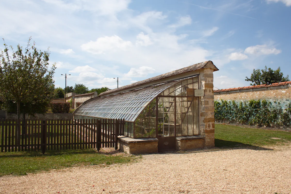
If you want to extend the day, choose one nearby place. The Salomon garden greenhouses, Saint-Amand church and the Château de Rosa Bonheur are all listed on the official Thomery page. Check visiting arrangements separately: passing a site on a walk does not mean that its interior is open.
Moret-sur-Loing is another logical addition, particularly without a car. Its old centre and riverbanks are easy to explore on foot, and you can read the story of DouceSoeurs and Roslina. For an organised outing on the Loing, see Nature Loisir Évasion, but keep canoeing for another day if transfers, water levels or tired legs would make the timetable too tight.